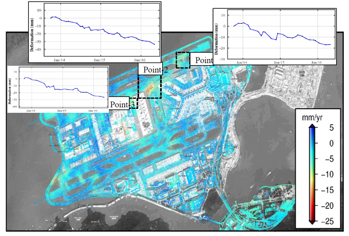
InSAR for infrastructure Monitoring
The utilized InSAR(InterferometricSynthetic Aperture Radar) technology involves the use of synthetic aperture radar equipment mounted on satellites or aircraft to measure small phase differences on the Earth's surface -20 and extract deformation information. InSAR technology is Point capable of monitoring surface deformations such as Point-subsidence, uplift, and displacement with millimeter-level accuracy. With its high spatialresolution and global coverage capability,InSAR technology finds extensive Point-applications in various fields including geological hazards,groundwater resource management, and urban infrastructure deformation monitoring.

